Total distance: 154 kilometres
Total legs: 8
Departure point: Milngavie
Arrival point: Fort William
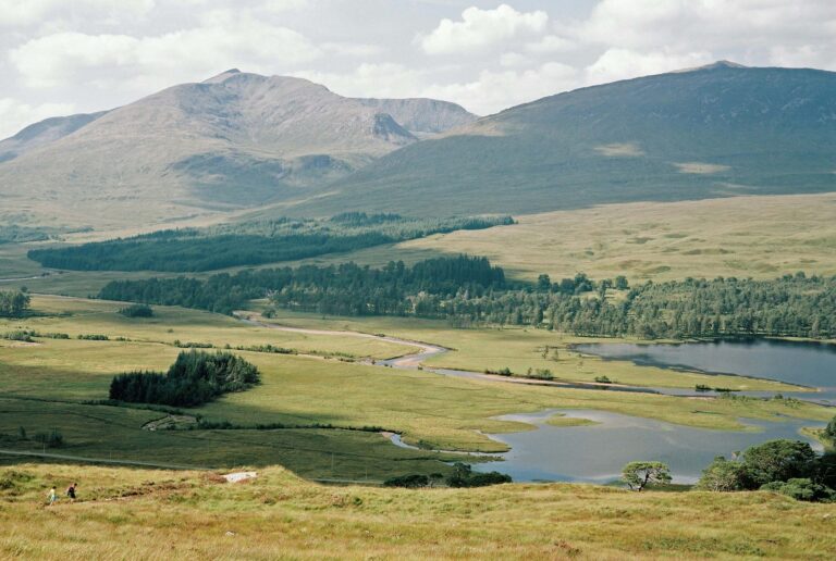
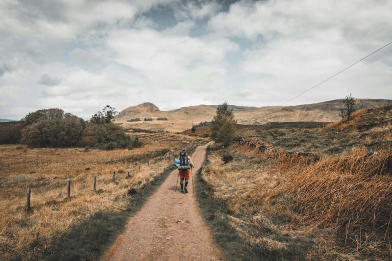
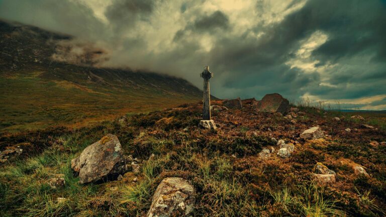
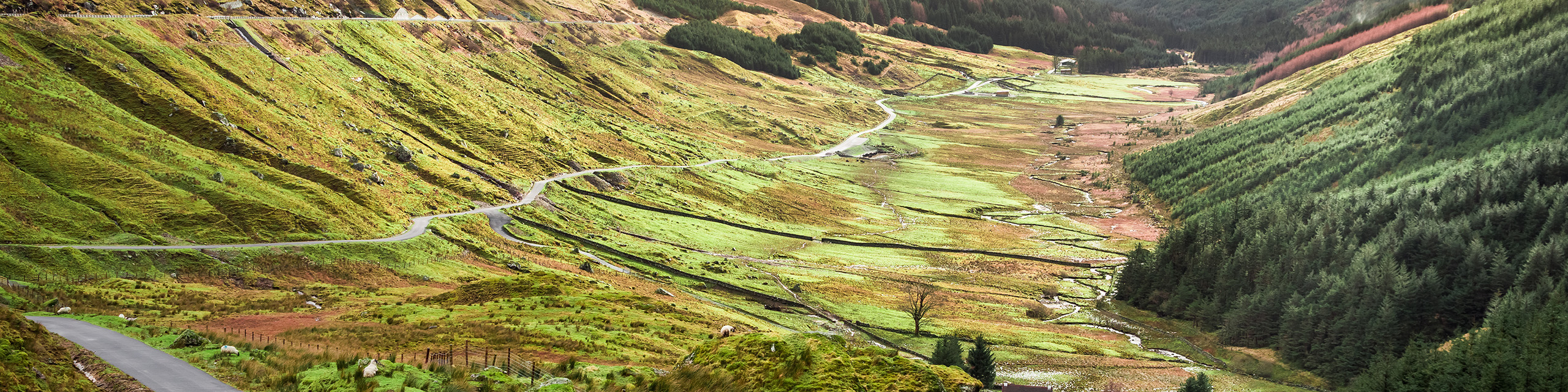
Established in 1980, the West Highland Way offers a captivating journey through Scotland’s natural beauty, including the striking landscapes of Loch Lomond, the atmospheric Rannoch Moor, and the challenging ascent of Devil’s Staircase. As one of the most popular long-distance trails in the United Kingdom, the West Highland Way provides a rewarding adventure for hikers seeking a blend of cultural richness and breathtaking scenery amid the heart of Scotland. The trail’s charm lies not only in its physical challenges but also in the cultural and historical treasures it unveils along the way, making it a must-experience for outdoor enthusiasts and nature lovers alike.
Stage 1: Milngavie to Drymen
Distance: 19 km / 12 mi
Click here for this stage’s GPX file
Stage 2: Drymen to Rowardennan
Distance 24 km / 15 mi
Click here for this stage’s GPX file
Stage 3: Rowardennan to Inverarnan
Distance: 22.5 km / 14 mi
Click here for this stage’s GPX file
Stage 4: Inverarnan to Tyndrum
Distance: 19.5 km / 12 mi
Click here for this stage’s GPX file
Stage 5: Tyndrum to Inveroran
Distance: 14.5 km / 9 mi
Click here for this stage’s GPX file
Stage 6: Inveroran to Kingshouse
Distance: 16 km / 10 mi
Click here for this stage’s GPX file
Stage 7: Kingshouse to Kinlochleven
Distance: 14.5 km / 9 mi
Click here for this stage’s GPX file
Stage 8: Kinlochleven to Fort William
Distance: 24 km / 15 mi
Click here for this stage’s GPX file
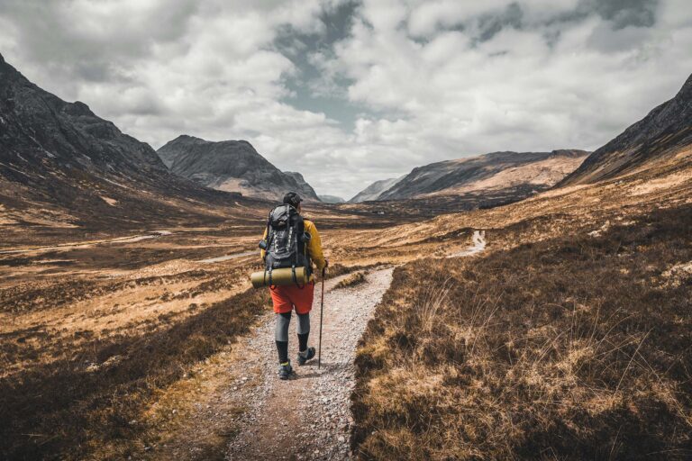
The West Highland Way h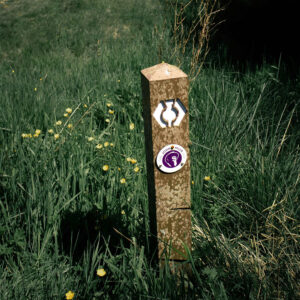 as excellent waymarking, with clear signposts adorned with the distinctive thistle logo and directional arrows throughout the entire route. While the path can be traversed in either direction, most hikers opt for the journey from Milngavie to Fort William. This choice allows for a gradual immersion into the stunning scenery, a gentle introduction to the walking route, and culminates with the iconic destination of Fort William.
Commemorate your journey and document your accomplishment by obtaining stamps for your Pilgrim Passport at designated Passport Points along the West Highland Way. Your passport purchase not only serves as a keepsake but also contributes to the upkeep of the West Highland Way.
You can purchase your Passport online on the official website of the West Highland Way.
Please be aware that the opening hours of Passport Points may vary, so it’s advisable to check in advance.
Passports can also be acquired at select West Highland Way businesses, such as Spar Milngavie, Gavin’s Mill, The Honeybee Bakery, and Creature Comforts in Milngavie, as well as Drymen Bakery & Deli or Shandon Farmhouse in Drymen.
It is possible to obtain an official West Highland Way Certificate at the end of your adventure.
For more information please visit this website.
Hostels
Click here for an overview of hostels along the route
B&Bs – Guesthouses
Click here for an overview of B&Bs and guesthouses along the route
Hotels
Click here for an overview of hotels along the route
Inns
Click here for an overview of hotels along the route
Campsites
Click here for an overview of campsites along the route
Wild camping
According to the Scottish Outdoor Access Code, wild camping is allowed. This style of camping emphasizes lightness, involves small groups, and is limited to two or three nights in a single location. To avoid inconveniencing local residents and land managers, refrain from camping in enclosed fields with crops or farm animals, and maintain a distance from buildings, roads, or historic structures. Adhere to the principle of leaving no trace by carrying away all litter, erasing any signs of your tent pitch or open fire, and avoiding any form of pollution. Additionally, please be aware that camping byelaws are in effect within the Loch Lomond & The Trossachs National Park between March and September.
Click here for an overview of food & drink places along the route.
Click here for an overview of shops for provisions along the route.
Click here for an overview of where to find top-up water taps along the route.
While May stands out as the favored month for traversing the West Highland Way, this popularity exerts pressure on accommodation availability. Nonetheless, the trail is accessible throughout the year, with the spring and autumn seasons offering particularly stunning landscapes. To enhance the chances of securing accommodation, especially during peak periods, consider starting the walk on a day other than Saturday. This strategic approach can contribute to a more seamless and enjoyable experience along the West Highland Way.
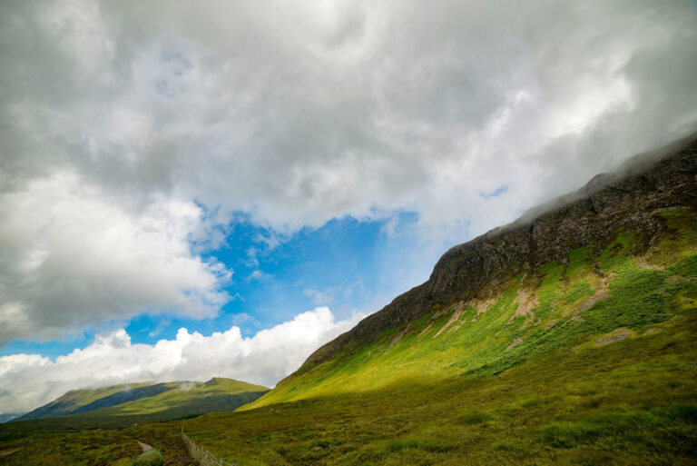
The weather conditions along the West Highland Way can vary significantly due to the diverse landscapes it covers, ranging from lowland moors to mountainous terrain. It’s essential for hikers to be prepared for a mix of weather conditions, as Scotland is known for its changeable and sometimes unpredictable climate. Here is a general overview:
Rainfall: Scotland is known for its rainfall, and the West Highland Way is no exception. Rain can occur at any time of the year, so waterproof gear is essential.
Temperature: The temperatures can vary, with cooler temperatures in the higher elevations. Even during the summer months, it’s advisable to bring layers and be prepared for cooler evenings.
Wind: The trail passes through open and exposed areas, especially in the mountainous sections. Hikers should be prepared for windy conditions, especially at higher elevations.
Snow: In the winter months, especially in the northern sections, there is a possibility of encountering snow. Snowfall can impact trail conditions, so hikers should check conditions and be adequately equipped.
Midges: In the warmer months, especially around June and July, midges (small flying insects) can be prevalent. It’s advisable to bring insect repellent to mitigate their impact.
Sunshine: While Scotland is not known for constant sunshine, there are sunny days, especially during the summer. Hikers should still bring sun protection like sunscreen and sunglasses.
It’s crucial for anyone planning to hike the West Highland Way to check the weather forecast regularly, pack accordingly, and be prepared for changing conditions. Additionally, having a backup plan or being flexible with the itinerary can be beneficial in case of unexpected weather challenges.
There are several guidebooks available for the West Highland Way. Make sure to choose the most updated guidebook upon purchase, as information can change quickly along the route (such as accommodations, shops, passport points, etc.).
Here are some of the guidebooks currently available for the West Highland Way:
Cicerone
The West Highland Way: Milngavie to Fort William Scottish Long Distance Route
Birlinn
The West Highland Way
Knife Edge Outdoor Guidebooks
Trekking the West Highland Way: two-way guide
The Walkhighlands app enables you to discover nearby walks and download comprehensive walking routes to your phone in advance, ensuring you have access to both the detailed description and the corresponding route map even in areas with no signal. The route maps utilize your phone’s GPS to display your current position accurately.
To install the App, please visit this website with your mobile device and follow the instructions.
There are several companies along the West Highland Way offering luggage transport.
You can find more information on this webpage.
For more information please visit the official webite of the West Highland Way.