Sweden
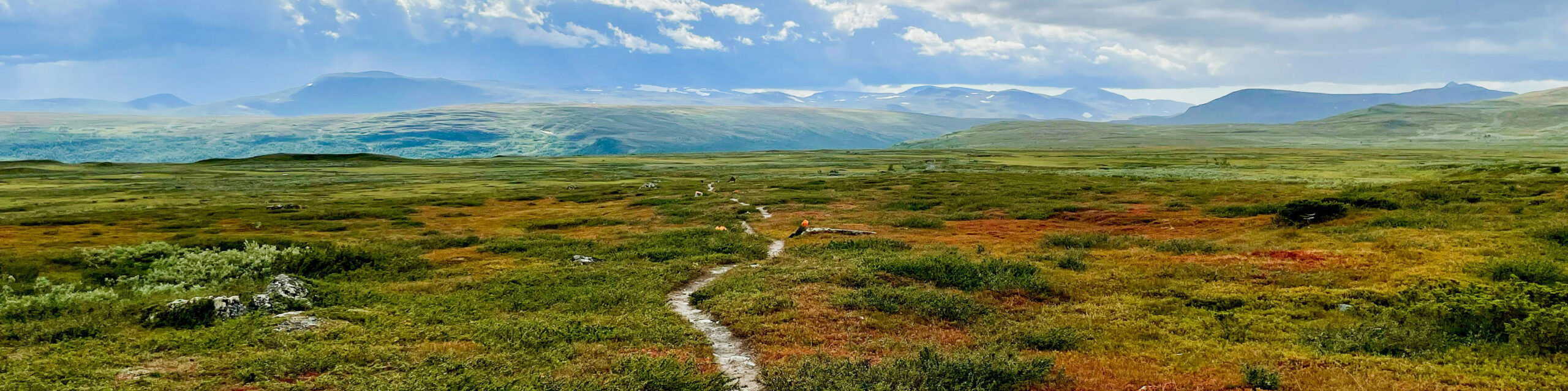
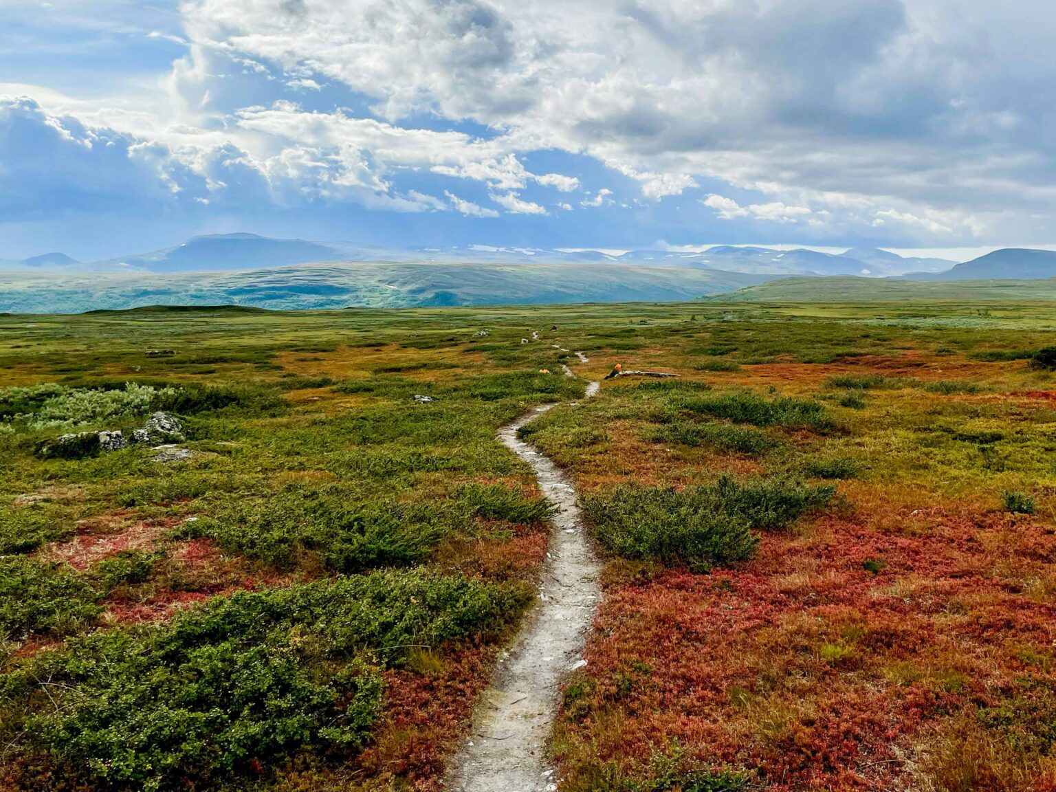
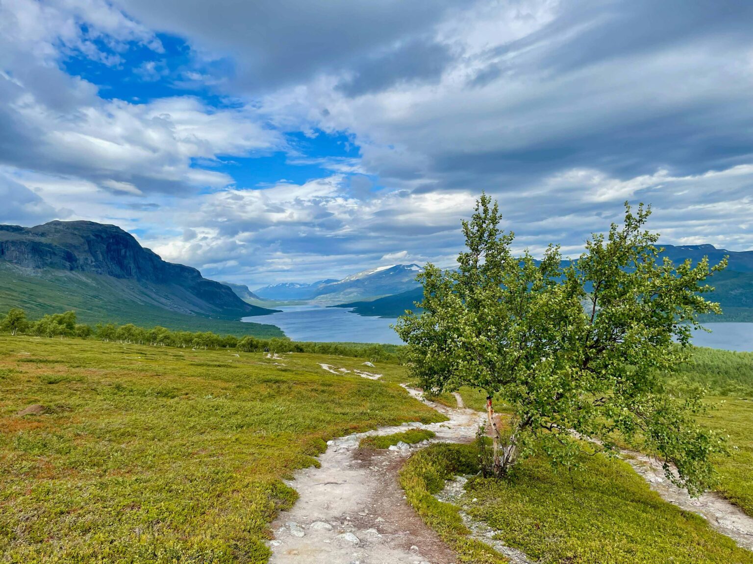
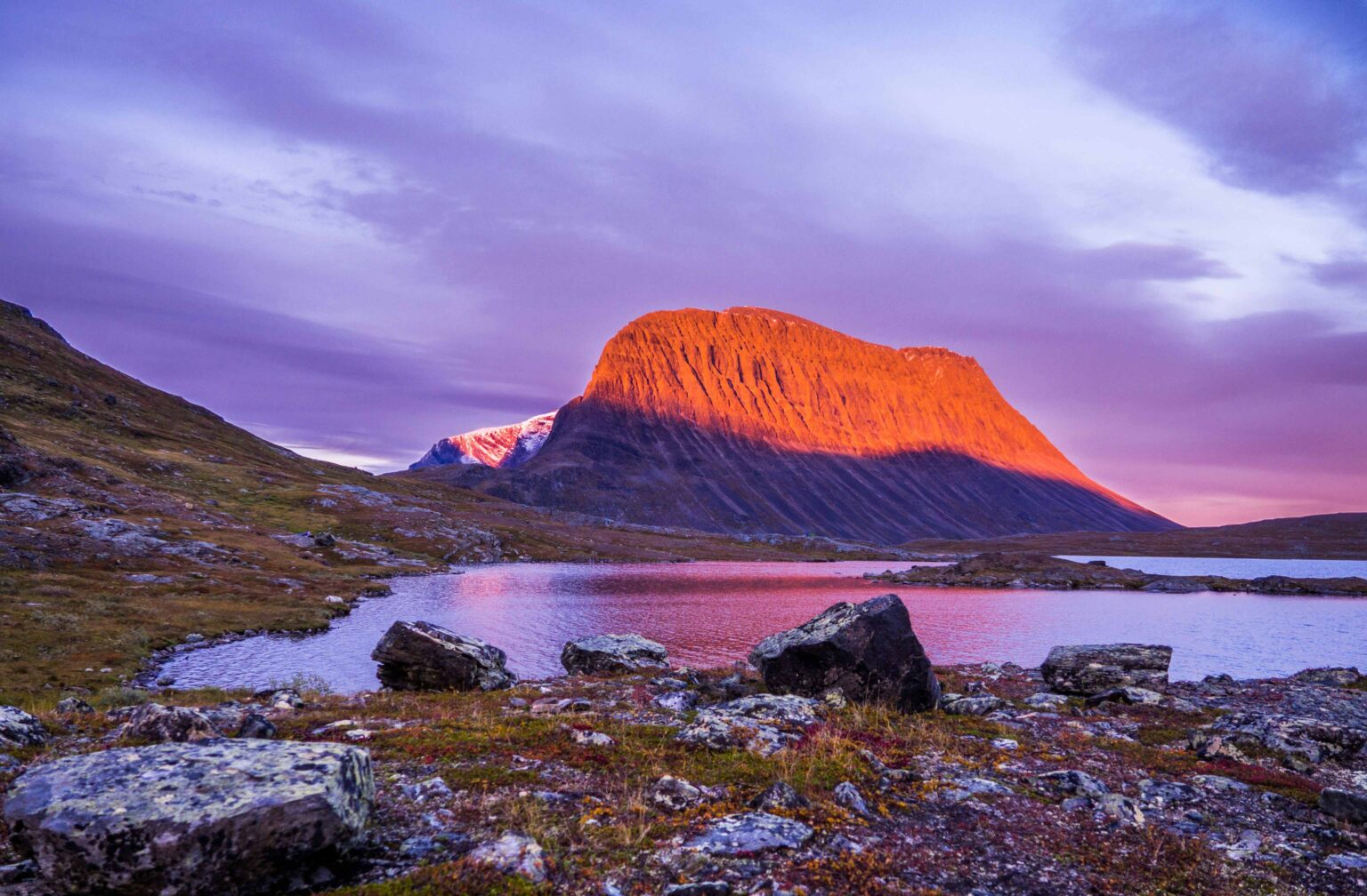
The Kungsleden, translated as the “King’s Trail,” is a renowned long-distance hiking trail in Sweden, offering breathtaking views of the country’s pristine wilderness. Extending between 450 and 500 kilometers (280-311 miles) through the Swedish Lapland, the trail winds its way from Abisko in the north to Hemavan in the south. The Kungsleden passes through diverse landscapes, including expansive birch forests, rocky mountain terrain, and high plateaus, showcasing the stunning beauty of the Arctic region.
Hikers on the Kungsleden trail encounter a mix of challenging sections and more accessible paths, making it suitable for a range of skill levels. The trail is divided into five main sections, with well-marked routes and well-maintained huts providing accommodation along the way. One of the highlights of the Kungsleden is the dramatic Lapporten mountain pass and the opportunity to witness the mesmerizing Northern Lights in the winter months.
Total length: approximately 440 km
Total stages: 15-20 days for most hikers
Departure: Abisko
Arrival: Hemavan
The idea and creation of the Kungsleden can be attributed to an initiative led by the Swedish Tourist Association (STF). The Swedish Tourist Association played a crucial role in the development and promotion of the trail. The organization aimed to provide a scenic hiking route through the remote and stunning landscapes of Swedish Lapland, showcasing the natural beauty of the region and promoting outdoor recreation.
The construction of the Kungsleden began in the early 20th century, with the first section between Abisko and Nikkaluokta completed in 1902. The establishment of mountain huts along the trail, which served as accommodation and safety shelters for hikers, was a key aspect of the initiative. Over the years, additional sections were added, resulting in the complete trail extending from Abisko in the north to Hemavan in the south.
Below you will find the main Kungsleden route, but as you can tell from the map on the website of the Swedish Tourist Association, several variants and other options exist. Therefore keep in mind that this is not the only way to walk the Kungsleden trail.
As we mentioned before in the introductory paragraph, the Kungsleden trail in Sweden is comprised of 5 official sections. 4 of these sections are equipped with mountain huts as accommodation. The other remaining section, from Kvikkjokk to Ammarnäs, is the least walked part of the Kungsleden walking trail and requires several nights of camping.
Kungsleden section 1: from Abisko to Nikkaluokta | |
Stage 1: from Abisko to Abiskojaure | Stage 5: from Sälka to Singi |
Stage 2: from Abiskojaure to Alesjaure | Stage 6: from Singi to Kebnekaise |
Stage 3: from Alesjaure to Tjäktja | Stage 7: from Kebnekaise to Nikkaluokta |
Stage 4: from Tjäktja to Sälka |
|
Kungsleden section 2: from Nikkaluokta to Vakkotavare | |
Stage 1: from Nikkaluokta to Kebnekaise | Stage 4: from Kaitumjaure to Teusajaure |
Stage 2: from Kebnekaise to Singi | Stage 5: from Teusajaure to Vakkotavare |
Stage 3: from Singi to Kaitumjaure |
|
Kungsleden section 3: from Saltoluokta to Kvikkjokk | |
Stage 1: from Saltoluokta to Sitojaure | Stage 3: from Aktse to Pårte |
Stage 2: from Sitojaure to Aktse | Stage 4: from Pårte to Kvikkjokk |
Kungsleden section 4: from Kvikkjokk to Ammarnäs |
Distance: 184 km / 114 mi The section from Kvikkjokk to Ammarnäs is as the least travelled portion of the Kungsleden hiking trail, necessitating multiple nights of camping. Yet, the journey offers splendid vistas, particularly within Pieljekaise National Park. August and September are considered to be the prime months to travel this stretch, with the landscape adorned in vibrant orange hues and the absence of mosquitoes. Make sure to stock up on supplies when you leave from Kvikkjokk, since you won’t be encountering many inhabited areas along the way. The first opportunity you will have again to do groceries after leaving Kvikkjokk, is in the town of Jakkvik. It will take you a little over 90 km (56 mi) to reach Jakkvik. Only 20-25 km after Jakkvik you will arrive in the town of Adolfsström, which will be your last opportunity to go some grocery shopping before arriving in Ammarnäs. Undoubtedly, the trail presents challenges with its undulating terrain, featuring several hundred meters of elevation gain between valleys and plateaus. It boasts a distinctive ambiance with several small villages, cabins, and crofts. Opportunities for extended boat excursions are also available, easily arranged on-site. Of particular note is the Svaipa bird conservation area, a captivating destination for ornithologists, while traversing the prairie-like expanses of Björkfjället broadens one’s perspectives. The final leg toward Ammarnäs unfolds along a lengthy ridge, offering breathtaking views of the river valley. For those seeking to embark on this adventure, buses are available from Murjek or Jokkmokk to Kvikkjokk, and from Vännäs to Ammarnäs. Click here to view the GPX track of Kungsleden section 4 Click here to download the GPX track of Kungsleden section 4 As you can see, we have not divided this section into single stages, because we think it’s up to everyone’s personal preferences and physical capacities to decide where to stop for the night and how long to walk each day. |
Kungsleden section 5: from Ammarnäs to Hemavan | |
Stage 1: from Ammarnäs to Aigert | Stage 4: from Tärnasjö to Syter |
Stage 2: from Aigert to Serve | Stage 5: from Syter to Viterskalet |
Stage 3: from Serve to Tärnasjö | Stage 6: from Viterskalet to Hemavan |
Most part of the Kungsleden trail is typically well-defined and easily navigable, often marked by red paint on rocks and stones indicating the correct route in the absence of signage. Additionally, sturdy bridges conveniently span any water crossings, eliminating the need for fording streams or rivers.
The stages of the Kungsleden trail are designed to start and end at so-called STF mountain stations or cabins.
Because of these mountain stations and cabins along the trail, it is possible to hike the Kungsleden without a tent (except for section 4 between Kvikkjokk to Ammarnäs). If you prefer to sleep in your tent, be aware that in certain areas along the Kungsleden trail it is allowed only to set up camp near the mountain cabins.
Upon your arrival at a mountain cabin, you’ll be welcomed by the cabin host who will address any inquiries and provide an overview of your stay. Nestled far from the road, these cabins operate without electricity or running water, making the outhouse your primary facility. To foster a cooperative atmosphere, guests help each other by fetching firewood and replenishing water supplies. Accommodation varies in size, with most rooms featuring gas stove heating for comfort. Expect restful nights in bunk beds, complete with duvets and pillows provided. While we supply bedding, including duvets and pillows, it is recommended to bring your own bedsheets and pillowcases, as well as a sleeping bag, travel sheet, or duvet cover for hygiene and safety reasons.
Please be aware that the STF mountain cabins are not open all year round, but only for approximately 5 months in total each year. Click here to view the official openings months for 2024.
Until several years ago it was not possible to pre-book your stay in an STF mountain cabin, but this has changed. It is recommended to pre-book your stay, also because it is a bit cheaper. If however you prefer the flexibility of not booking, it is said that nobody will ever be turned away from a mountain cabin even if there are no beds available.
Click here for more information about STF mountain stations
Click here for more information about STF mountain cabins
For most of the stages along the Kungsleden trail you will either be sleeping in your own tent or at a mountain cabin. These mountain cabins are equipped with a kitchen where you can cook your own meal. Many hikers make sure to bring foods supplies with them, although many mountain cabins also have a small shop attached to them where they sell a select range of foods.
Rather than depending on finding food at the mountain cabins, we recommend that you always bring some food with you in case nothing is available at the mountain cabin.
The Swedish Tourist Association has done an amazing job in making sure hikers will find enough provisions along the trail without having to bring kilos of food with them in their backpacks.
Most of the mountain stations and mountain cabins are equipped with a little mountain shop next to them. There hikers can find the most essential foods to continue their journey.
Click here to view the map that shows stations and huts with a shop
Click here for general information about STF mountain shops
When choosing the season in which you’d like to walk the King’s Trail, there are two main factors you should keep in mind: the opening months of the STF mountain cabins and the high mosquito season.
Yes, this may sound weird, mosquitoes in Swedish Lapland where it’s usually so cold? But it is a true issue for hikers on the trail in the summer months. The clouds of annoying mosquitoes will appear as soon as the weather gets a bit warmer, and at times they will make it difficult for you to take breaks in between walking. If you want to avoid meeting these nasty little insects, the alternative is to walk before or after the summer which however means you may find mountain cabins closed and you’ll very likely have to face colder and wetter weather conditions.
In general, the STF mountain cabins are open for a total of approximately 5 months per year: during (late) winter and in summer. They remain closed between mid-April and mid-June and between mid-September and mid-February.
Click here to view the official opening months for 2024
Several guidebooks are available for the King’s Trail. When choosing your guidebook, make sure to buy the most recent version available.
Here are the main guidebooks currently on the market:
Cicerone Press
Trekking the Kungsleden: the King’s Trail through Northern Sweden
Sandiburg Press
Plan & Go | Kungsleden: all you need to know to complete Sweden’s Royal Trail
Outdoor – Conrad Stein Verlag
Schweden: Kungsleden (in German)
For more information about the Kungsleden Trail in Swedish Lapland, please visit the website of the Swedish Tourist Association.