Total length: 505 km
Total stages: 26
Departure point: Pieterburen
Arrival point: Sint-Pietersberg
The Pieterpad was conceived and developed by two Dutchwomen, Toos Goorhuis-Tjalsma and Bertje Jens. They began working on the idea in the late 1970s, and the trail was officially opened on May 21, 1983. Toos Goorhuis-Tjalsma and Bertje Jens wanted to create a long-distance walking route that traversed the Netherlands from north to south, showcasing the country’s diverse landscapes, nature, and cultural heritage.
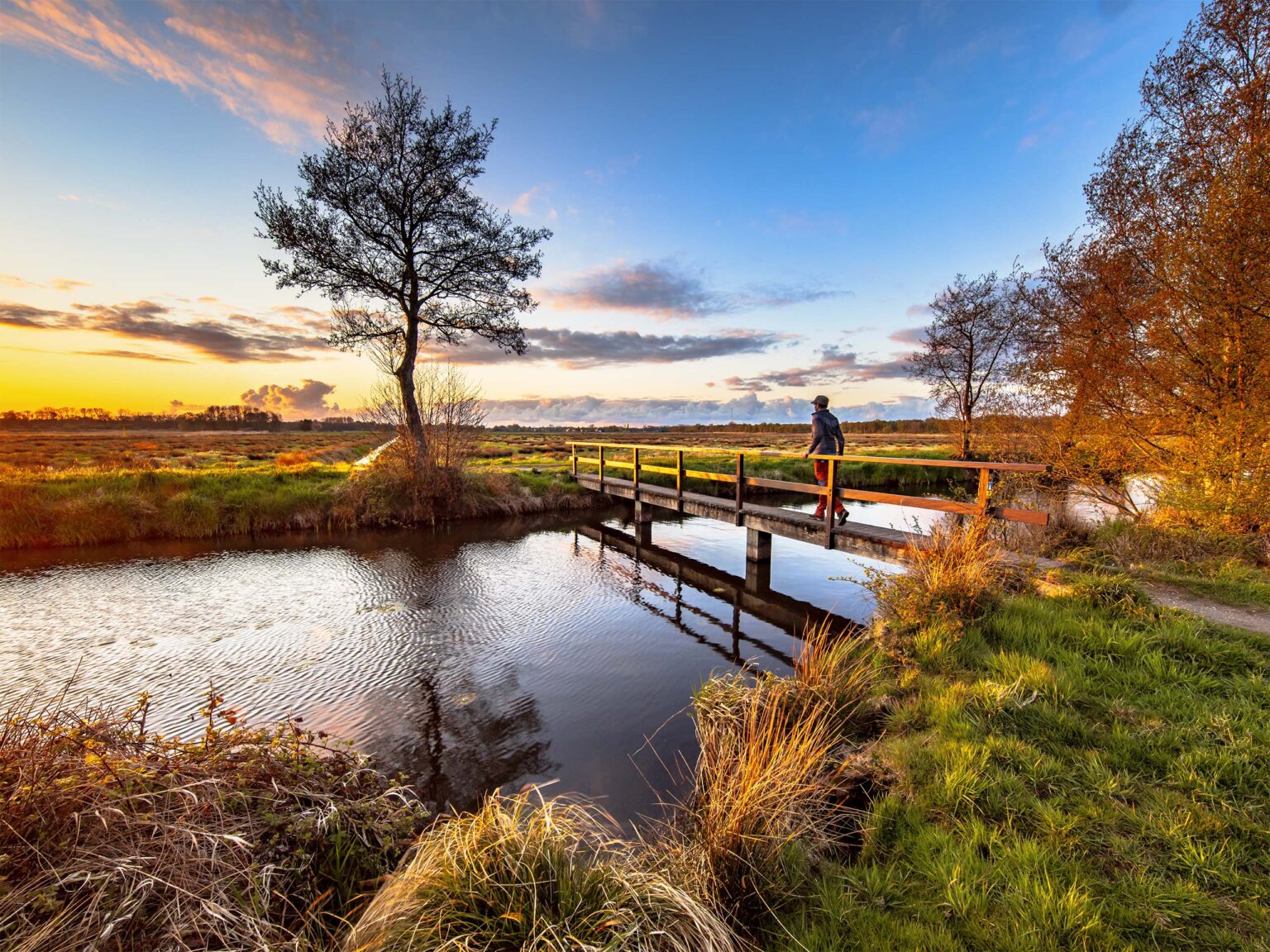
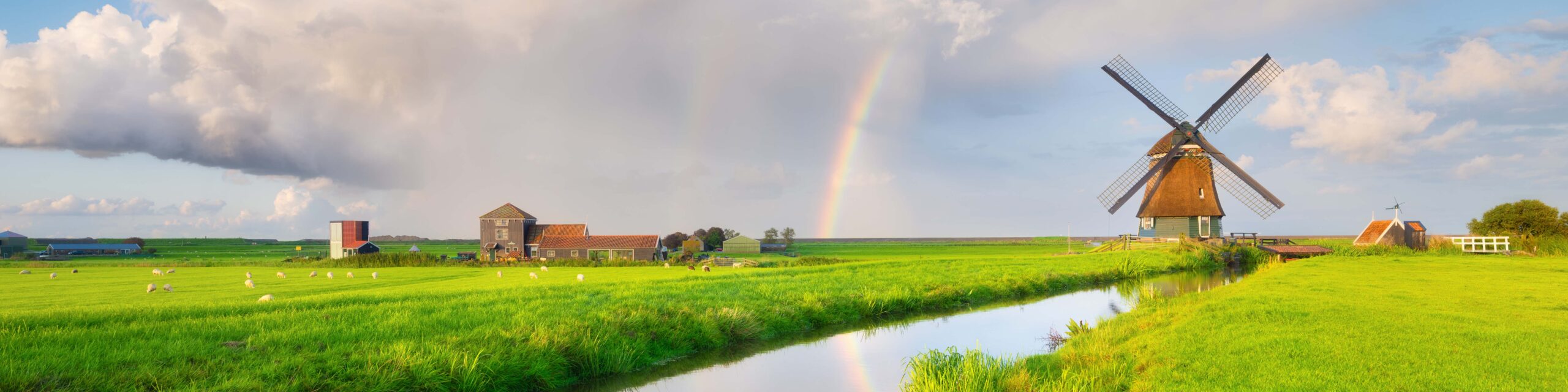
The Pieterpad covers a distance of approximately 505 kilometers (314 miles), leading from Pieterburen in the northern province of Groningen to the Sint-Pietersberg near Maastricht in the southern province of Limburg. The trail passes through various regions, including the provinces of Groningen, Drenthe, Overijssel, Gelderland, Brabant, and Limburg. Hikers can experience a wide range of landscapes, from coastal areas and forests to heathlands and hilly terrain.
Over the years, the Pieterpad has gained popularity among hikers and outdoor enthusiasts. It is well-marked with white and red signs featuring a stylized silhouette of a walking man, making it relatively easy to follow. The trail not only provides a physical challenge but also allows walkers to explore the rich cultural history and natural beauty of the Netherlands.
The Pieterpad has since become an iconic long-distance hiking trail, attracting both Dutch and international walkers who seek to experience the diverse landscapes and picturesque scenery that the Netherlands has to offer.
The official number of stages along the Pieterpad is 26. Most of these are medium-length stages without any significant altitude differences (remember we’re in the Netherlands, which literally means “low lands” so not lots of mountains around).
Some walkers however prefer to walk more or less kilometres in one day compared to the official stages. Below you will find three options on how to organize your stages, based on how many kilometres you’re comfortable with walking per day.
Stage | Normal duration: 26 stages |
| Shorter duration: 16 stages |
| Longer duration: 38 stages |
|
1 | 12 km / 7.5 mi | Pieterburen – Groningen | 34 km / 21.1 mi | Pieterburen – Winsum | 12 km / 7.5 mi | |
2 | 22 km / 13.7 mi | Groningen – Gasteren | 31 km / 19.3 mi | Winsum – Groningen, Zernikeplein | 17 km / 10.6 mi | |
3 | 21 km / 13 mi | Gasteren – Schoonloo | 26 km / 16.2 mi | Groningen, Zernikeplein – Haren, P+R A28 | 13 km / 8.1 mi | |
4 | 17 km / 10.6 mi | Schoonloo – Sleen | 23 km / 14.3 mi | Haren, P+R A28 – Zuidlaren | 15 km / 9.3 mi | |
5 | 18 km / 11.2 mi | Sleen – Gramsbergen | 31 km / 19.3 mi | Zuidlaren – Rolde | 17 km / 10.6 mi | |
6 | 23 km / 14.3 mi | Gramsbergen – Ommen | 30 km / 18.6 mi | Rolde – Papenvoort, Papenvoort 31 | 12 km / 7.5 mi | |
7 | 21 km / 13 mi | Ommen – Holten | 36 km / 22.4 mi | Papenvoort, Papenvoort 31 – Schoonloo, Ellertshaar | 9 km / 5.6 mi | |
8 | 19 km / 11.8 mi | Holten – Vorden | 28 km / 17.4 mi | Schoonloo, Ellertshaar – Schoonoord, Center | 10 km / 6.2 mi | |
9 | 21 km / 13 mi | Vorden – Braamt | 35 km / 21.8 mi | Schoonoord, Center – Sleen | 13 km / 8.1 mi | |
10 | 21 km / 13 mi | Braamt – Leuth | 32 km / 19.9 mi | Sleen – Dalen, Station (off-route) | 16 km / 9.9 mi | |
11 | 15 km / 9.3 mi | Leuth – Gennep | 28 km / 17.4 mi | Dalen, Station – Gramsbergen, Station | 16 km / 9.9 mi | |
12 | 15 km / 9.3 mi | Gennep – Wanssum | 34 km / 21.1 mi | Gramsbergen, Station – Rheeze, Ringweg | 15 km / 9.3 mi | |
13 | 14 km / 8.7 mi | Wanssum – Venlo | 29 km / 18 mi | Rheeze, Ringweg – Ommen | 15 km / 9.3 mi | |
14 | 17 km / 10.6 mi | Venlo – Melick | 35 km / 21.8 mi | Ommen – Lemele (church) | 11 km / 6.8 mi | |
15 | 17 km / 10.6 mi | Melick – Sittard | 33 km / 20.5 mi | Lemele (church) – Hellendoorn, Raadhuisstraat | 11 km / 6.8 mi | |
16 | 25 km / 15.5 mi | Sittard – Sint Pietersberg | 39 km / 24 mi | Hellendoorn, Raadhuisstraat – Holten | 15 km / 9.3 mi | |
17 | 20 km / 12.4 mi |
|
| Holten – Laren | 15 km / 9.3 mi | |
18 | 15 km / 9.3 mi |
|
| Laren – Vorden | 13 km / 8.1 mi | |
19 | 19 km / 11.8 mi |
|
| Vorden – Zelhem, Het Zonnetje | 15 km / 9.3 mi | |
20 | 24 km / 14.9 mi |
|
| Zelhem, Het Zonnetje – Doetinchem, Slangenburg Castle | 11 km / 6.8 mi | |
21 | 21 km / 13 mi |
|
| Doetinchem, Slangenburg Castle – Braamt | 11 km / 6.8 mi | |
22 | 23 km / 14.3 mi |
|
| Braamt – Elten, Spykscherweg | 12 km / 7.5 mi | |
23 | 22 km / 13.7 mi |
|
| Elten, Spykscherweg – Millingen aan de Rijn | 13 km / 8.1 mi | |
24 | 24 km / 14.9 mi |
|
| Millingen aan de Rijn – Beek, Sportpark | 14 km / 8.7 mi | |
25 | 22 km / 13.7 mi |
|
| Beek, Sportpark – Plasmolen, Rijksweg | 15 km / 9.3 mi | |
26 | 17 km / 10.6 mi |
|
| Plasmolen, Rijksweg – Heijen, Heiland | 17 km / 10.6 mi | |
27 |
|
|
|
| Heijen, Heiland – Vierlingsbeek | 13 km / 8.1 mi |
28 |
|
|
|
| Vierlingsbeek – Geijsteren (church) | 12 km / 7.5 mi |
29 |
|
|
|
| Geijsteren (church) – Swolgen | 15 km / 9.3 mi |
30 |
|
|
|
| Swolgen – Grubbenvorst, Schoolstraat | 11 km / 6.8 mi |
31 |
|
|
|
| Grubbenvorst, Schoolstraat – Tegelen, Glazenapstraat | 16 km / 9.9 mi |
32 |
|
|
|
| Tegelen, Glazenapstraat – Swalmen | 18 km / 11.2 mi |
33 |
|
|
|
| Swalmen – Sint Odiliënberg, Bernhardlaan | 16 km / 9.9 mi |
34 |
|
|
|
| Sint Odiliënberg, Bernhardlaan – Peij, Brugweg/Houtstraat | 15 km / 9.3 mi |
35 |
|
|
|
| Peij, Brugweg/Houtstraat – Sittard | 16 km / 9.9 mi |
36 |
|
|
|
| Sittard – Spaubeek, Station | 11 km / 6.8 mi |
37 |
|
|
|
| Spaubeek, Station – Berg en Terblijt, Lindenstraat | 15 km / 9.3 mi |
38 |
|
|
|
| Berg en Terblijt, Lindenstraat – Sint Pietersberg | 14 km / 8.7 mi |
The Pieterfietspad (Pieterbike path) is the official cycling counterpart to the popular Pieterpath. While the Pieterpath connects the most beautiful hiking trails, the Pieterbike path does the same with cycling paths. So, hop on your bike and explore the Netherlands by cycling.
The Pieterbike path covers approximately 580 km, connecting all the stage locations of the Pieterpath hiking route. Utilizing the cycling node network, this route is suitable for recreational cyclists as well as users of mobility scooters or electric wheelchairs. Check below for more information about the publication and the route, or visit the store to order your own copy of the Pieterbike path.
Below you will find a map with the full bicycle route of the Pieterpad, and for more information (incl. paper maps) we invite you to visit the dedicated page on the official Pieterpad website.
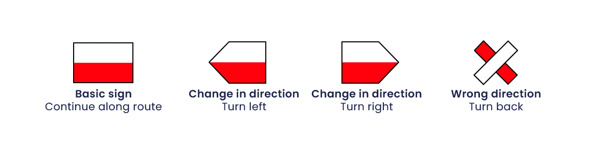
The Pieterpad is indicated by the internationally recognized white-red stripes for long-distance hiking trails. These waymarkings are applied wherever possible on existing objects such as traffic poles, large stones, fences, trees, etc.
The waymarking can be implemented using either stickers or paint strokes. Volunteers check and maintain the markings twice a year to ensure their accuracy and visibility.
Unfortunately at the moment no Pieterpad pilgrim passport is available for walkers and cyclists along the route.
The explanation that the official Pieterpad website gives, is the following:
“Although covering the over 500 kilometers on foot from Pieterburen to the Sint Pietersberg is an achievement in itself, the Pieterpad is intended as a recreational experience with a focus on nature and culture, rather than a competitive race. As such, there are no stamp posts, and no medals are awarded. Of course, you can request stamps at locations along the route if you wish.“
Although no official Pieterpad passport can be purchased, an official Pieterpad Certificate and a Pieterpad Token are available. You can order a personalized certificate or an engraved medal from the online store on the Pieterpad website. The certificate is also for sale at Hotel Waddenweelde in Pieterburen (Hoofdstraat 82, Pieterburen) and at Buitengoed Slavante near the endpoint (Slavante 1, Maastricht).
Along the Pieterpad travelers can find a diverse range of accommodations catering to various preferences and budgets. Whether you prefer charming bed and breakfasts nestled in quaint villages, comfortable hotels offering modern amenities, or rustic lodgings surrounded by nature, there are options to suit every taste. These accommodations not only provide a restful haven for weary hikers but also offer a chance to immerse oneself in the local culture and hospitality, enhancing the overall experience of the Pieterpad journey.
For more information please check the accommodation webpage on the Pieterpad website and of course you can always keep an eye out on booking.com to see if there are any other good options along the route.
The Pieterpad traverses diverse landscapes, and the seasons bring distinct weather conditions along the trail.
Spring, from March to May, introduces blooming flora and milder temperatures, making it an ideal time for a vibrant and refreshing hike. However, early in spring temperatures can still be quite low and hikers should be prepared for lots of rain (and perhaps even still some snow!).
Summer, spanning June to August, brings warmer weather, longer days, and lush greenery, providing optimal conditions for outdoor activities. There is however no guarantee in the Netherlands that it will be warm and sunny during the summer, so make sure to bring your rain clothing and be prepared for some strong winds as well.
Fall, from September to November, showcases a spectrum of autumn colors as the foliage transforms, creating a picturesque setting for walkers. This is also the season of autumn storms and rain so be prepared!
Winter, December through February, brings cooler temperatures and occasional snowfall, offering a unique and serene atmosphere for those seeking a different Pieterpad experience.
It’s crucial for hikers to be prepared for varying weather conditions and plan accordingly, ensuring a safe and enjoyable journey along the Pieterpad. Please remember that the Netherlands have a North Sea climate, and weather can be unpredictable.
NIVON, the Dutch branch of Naturefriends International (NFI), offers two guidebooks for the Pieterpad, covering part 1 (Pieterburen to Vorden) and part 2 (Vorden to Maastricht). Unfortunately, no English translations are available, and they are solely in Dutch. Despite this, the guidebooks include valuable detailed maps. Many Pieterpad hikers carry them, providing insights into the route’s highlights, landscape, and history.
The decision to purchase the Pieterpad guidebooks depends on your preferences. While they offer a detailed Dutch description and clear route maps, they are relatively heavy, and the route may not always be accurate due to occasional detours. Nevertheless, buying them supports the Pieterpad Foundation, ensuring path accessibility and maintenance. The foundation regularly checks and corrects the route, providing detours when necessary.
For more details and information please visit the official website of the Pieterpad (in Dutch only).